"Leaning into the cart, winding slowly upward through the switchbacks"(The Road, pp. 25-26).
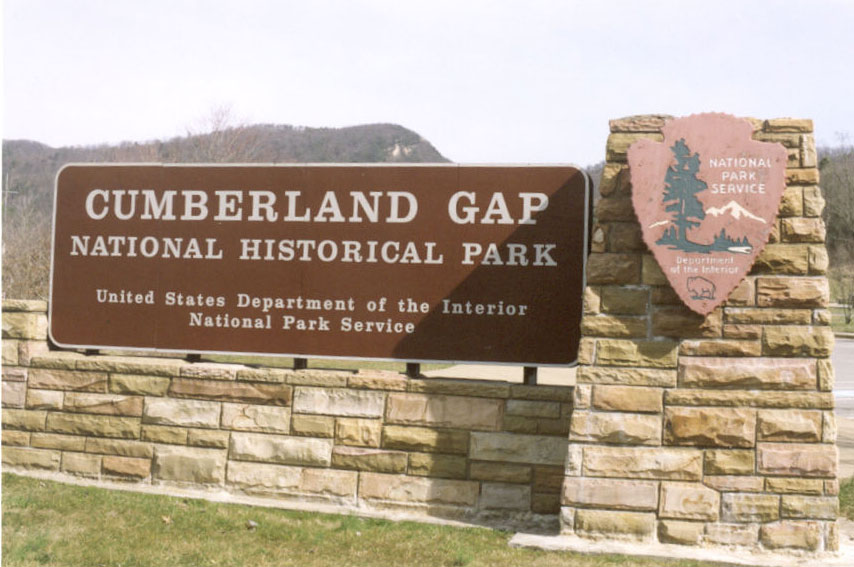
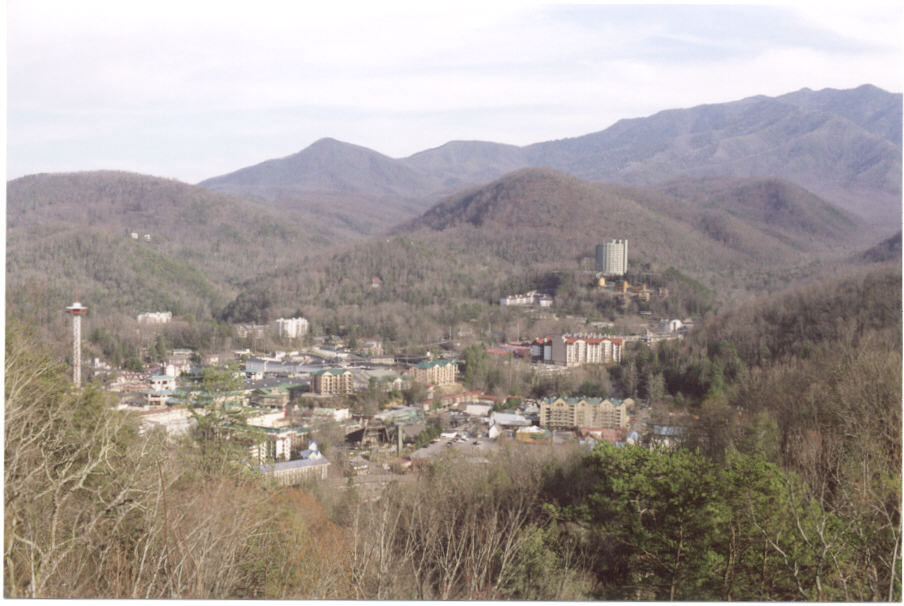
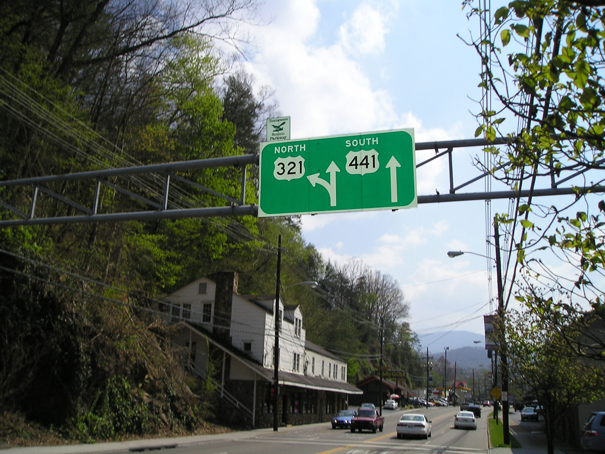
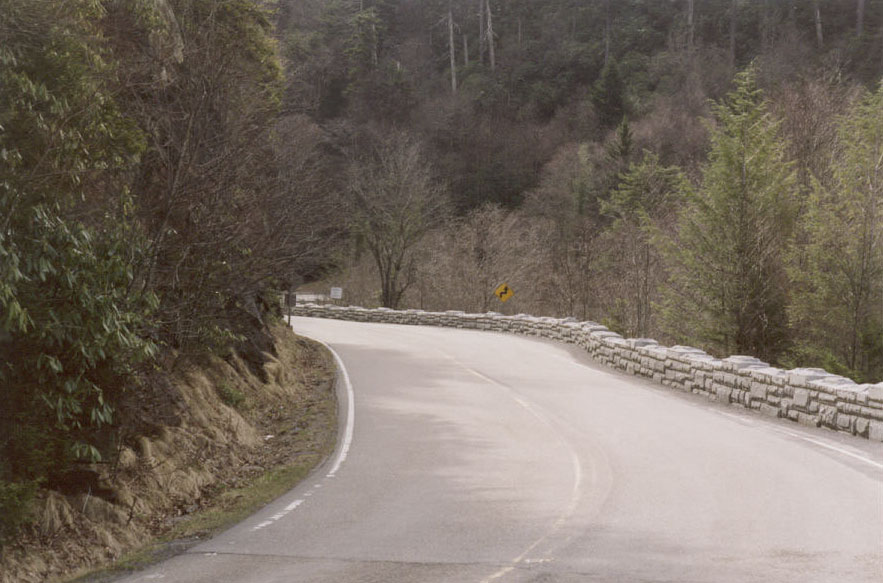
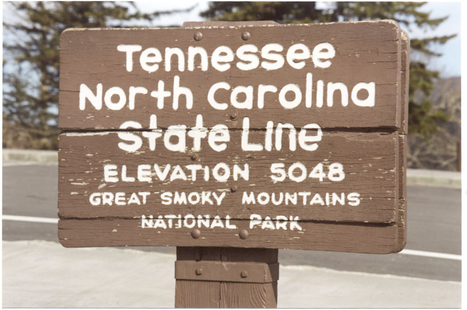
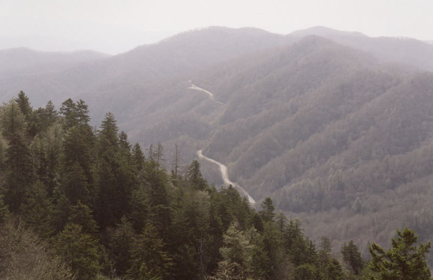
Another place along the route of The Road that can be specifically and unambiguously identified is Newfound Gap in the Great Smoky Mountains National Park. US-441 leaves Gatlinburg and climbs its way through a number of switchbacks toward the Tennessee-North Carolina border at the Gap. The giveaway detail is its altitude.
"The pass at the watershed was five thousand feet and it was going to be very cold"(The Road, p. 25).
"It didn't snow again but the snow in the road was six inches deep and pushing the cart up those grades was exhausting work"(The Road, p. 28).
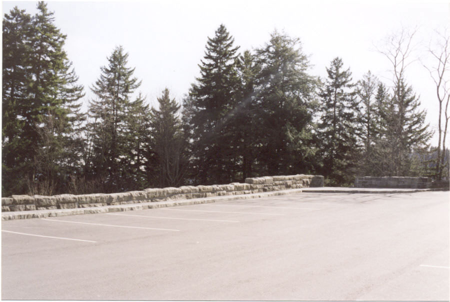
"The wind in the dead black stands of hemlock. The empty parking lot at the overlook"(The Road, p. 28).
"It was very cold. Toward the afternoon it began to snow again and they made camp early and crouched under the leanto of the tarp and watched the snow fall in the fire"(The Road, p. 29).
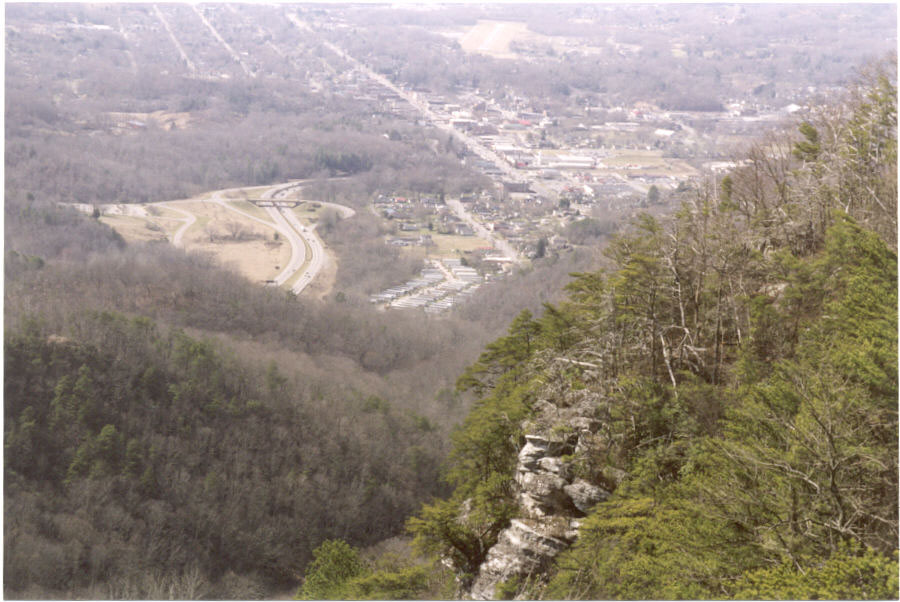
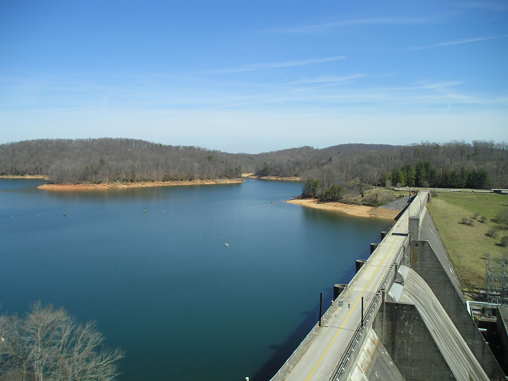
The altitude of Newfound Gap is 5,048 feet and is the lowest gap in the Smoky Mountains. The earliest road over the mountains went through Indian Gap at 5, 271 feet. The current route is lower, and shorter and was called the new found gap after its discovery. There is a large, seldom empty parking area at the gap, and it was the site of President Roosevelt's dedication of Park on Labor Day, 1940. Because of its scenic views it is a popular stopping point for travelers along US-441 and for hikers along the Appalachian Trail. According to the National Park Service, Newfound Gap is on average 10° F degrees cooler than the nearby lowlands and receives on average 69-inches of snow each year. The nearby stands of hemlock have been decimated in recent years by an infestation of the Hemlock Wooly Adelgid (Adelges tsugae Annand), an invasive species introduced on the east coast in 1951.
The parking area at the gap had been visited earlier in McCarthy's fiction by Suttree and his girlfriend, Joyce, during their cab ride to the mountains.
"At Newfound Gap there were skiers, a bright group bristling with their poles and skis about the parked cars"(Suttree, p. 400).
After crossing the mountains, the pair would have descended from the Gap and gone through Cherokee and then on to Franklin, NC, via one of several routes. I believe the most likely would have been through Bryson City, the place where Suttree emerges after his six weeks or so in the mountains (Suttree, p. 291), and then taken NC-28 through Wests Mill and Lotla. From Franklin they would continue on NC-28, US-64 southeast toward Highlands, NC.
"They came out along the rim of a deep gorge and far down in the darkness a river.
. . . High rock bluffs on the far side of the canyon with thin black trees clinging to the escarpment. The sound of the river faded. Then it returned"
(The Road, pp. 31-32).
This sounds like a description of Cullasaja Gorge and the route along NC-28, US-64 southeast of Franklin, NC. The river does become significantly separated from the highway at several points and alternates between wild rapids and lethargic drifting at others.
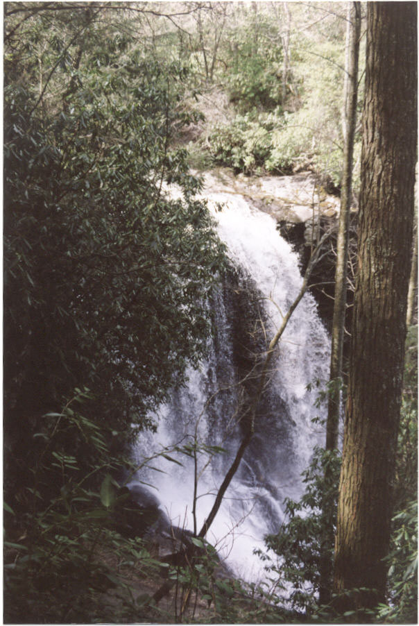
"They left the cart in a parking area and walked out through the woods. A low thunder coming from the river. It was a waterfall dropping off a high shelf of rock and falling eighty feet through a gray shroud of mist into the pool below"(The Road, p. 32).
The waterfall mentioned is likely Dry Falls. It is located in Cullasaja Gorge about 20.5 miles southeast of Franklin on the way to Highlands, NC, along NC-28, US-64. There is a small parking area just off the highway and a trail that leads a short distance down to the falls. The river falls 75-80 feet and is a popular tourist attraction. It is named Dry Falls because one can walk behind the falls and remain relatively dry.
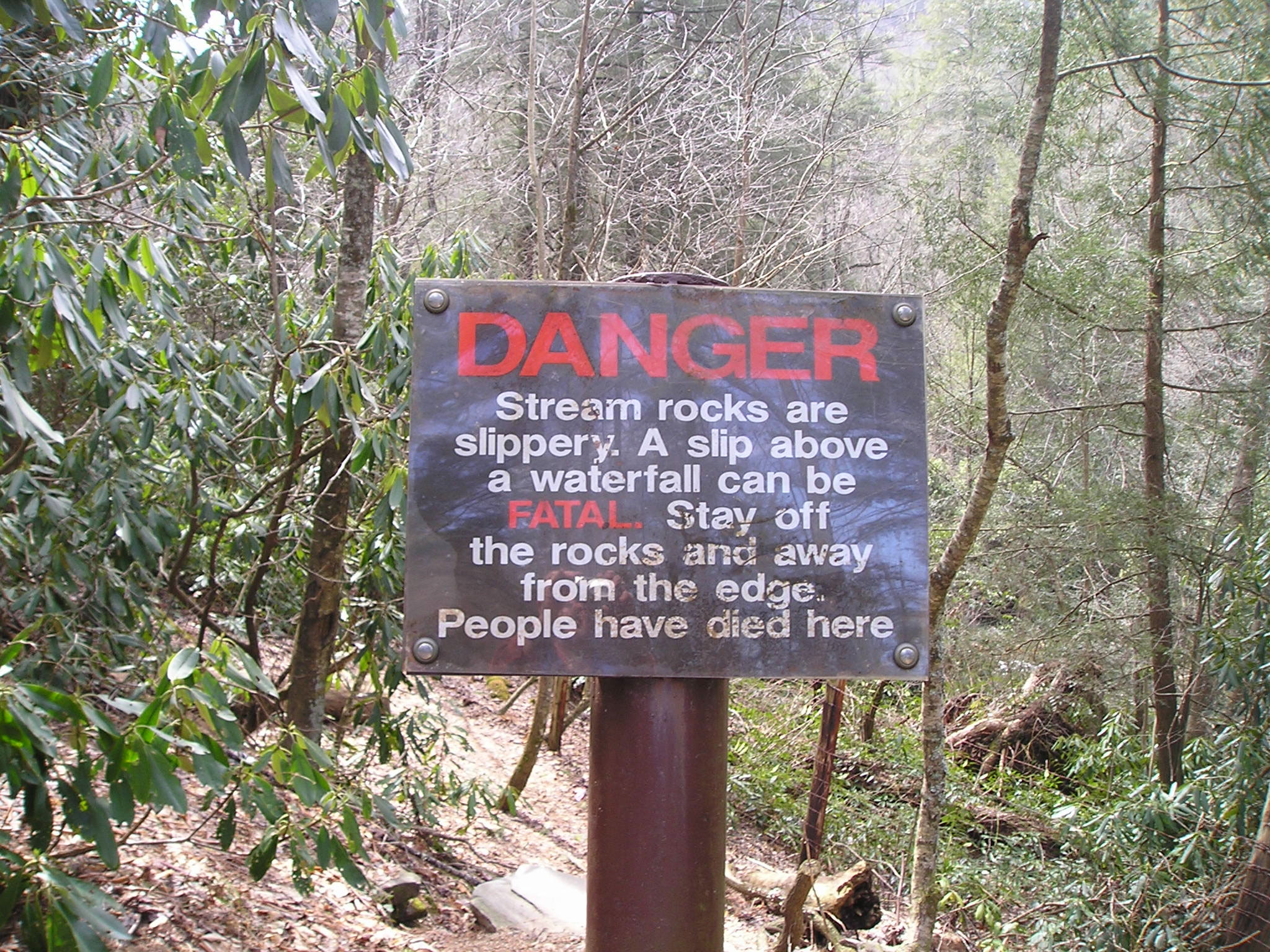
After the father and son swim in the pool below the falls, the reader is told,
"They dressed shivering and then climbed the trail to the upper river. They walked out along the rocks to where the river seemed to end in space and he held the boy while he ventured out to the last ledge of rock. The river went sucking over the rim and fell straight down into the pool below. The entire river. He clung to the man's arm.
It's really far, he said.
It's pretty far.
Would you die if you fell?
You'd get hurt. It's a long way.
It's really scary"(The Road, pp. 33-34).
Do you think that McCarthy (or the father) might have read the sign in the parking area near the river above Dry Falls that says:
"We have to keep moving. We have to keep heading south.
Doesn't the river go south?
No it doesn't"(The Road, p. 36).
The Cullasaja River is just to the northwest of the Eastern Continental Divide and indeed flows northwest into the Little Tennessee, Tennessee, Ohio and Mississippi Rivers to drain into the Gulf of Mexico. Highlands, NC, is located on the Divide.
An ancient mapmaker indicated the end of the known world by stating, "Here be dragons." I will have to admit that I become lost after Highlands. However, there are some interesting clues to places that someone more familiar with the Carolinas might be able to identify.
For example, after glassing the valley below them with binoculars the pair spotted a pale wisp of smoke.
"If it's a commune they'll have barricades"(The Road, p. 67).
According to their promotional material, the Boone-Douthit House, now the Rocky Retreat Bed & Breakfast in Pendleton, SC, served as a hippie commune during the 1960's and 1970's. Could this have been the commune that the father had in mind?
"Well. I think we're about two hundred miles from the coast. As the crow flies"(The Road, p. 132).
One could draw a line parallel and two hundred miles from the coast to identify possible locations. That line would pass about 40-miles south of Pendleton, SC. (Pendleton, SC to Charleston, SC = 244 mi.)
"He found a phone directory in a filling station and he wrote the name of the town on their map with a pencil. They sat on the curb in front of the building and ate crackers and looked for the town but they couldn't find it. He sorted through the sections and looked again. Finally he showed the boy. They were some fifty miles west of where he'd thought"(The Road, p. 153).
This town that they could not find on the map may well have been either Ellenton or Dunbarton, SC. During the period 1950-1951 the Federal Government condemned or bought land consisting of some 300 square miles for the Savannah River Project that completely eliminated these two towns as well as a number of other unincorporated communities. Some 6,000 people and 6,000 graves were relocated in the process.
If they continue south, keeping near streams and rivers and traveling generally downstream, they would eventually reach the South Carolina coast. The mention of the Piedmont reinforces that speculation.
Now to the question of when the novel is set. Following Mr. McGuire's one word of advice in the film, "The Graduate" (1967), the key to bounding the time frame of The Road may be "plastics." According to my research, the first disposable plastic safety razor (p. 128), the "Good News!" razor, was introduced in this country by Gillette in 1976. Similarly, Kendall Motor Oil seems to have introduced the first plastic bottles of motor oil (p. 6) in 1978. Barring anachronisms, this would suggest that the road trip takes place at the earliest in the late 1970's.
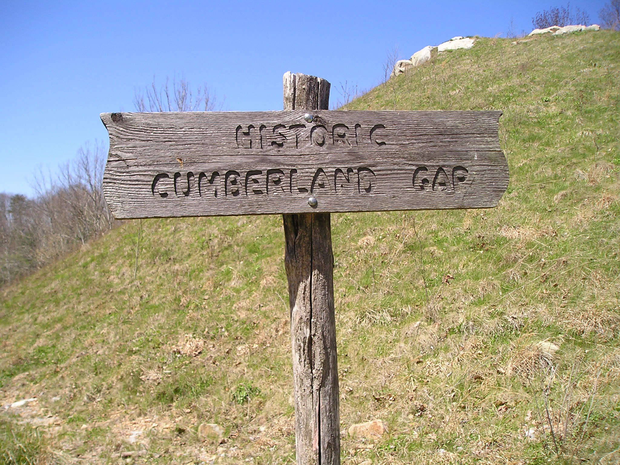
The latest that the trip could have taken place, again barring an anachronism, would seem to be the late 1990's. On October 18, 1996, the Cumberland Gap Tunnel was opened and the old route (US 25-E) through the Gap was closed and eventually dismantled to return the route of the Wilderness Road to its early Nineteenth Century wagon road state. The pavement removal was completed in 2002. Since the father and son went over the Gap on a road rather than a trail, it would have to have been before that date. Had the tunnel been open, it surely would have been a shorter and probably a more attractive route for the pair since they were pushing a loaded grocery cart.
In 1998, Robert Droz took some photographs along the old US-25E route through the Gap after the tunnel was opened but before the pavement had been removed. On May 27, 2002, the National Park Service opened the restored trail to the public.
Interestingly, there is a nearby railroad tunnel under the ridge to Cumberland Gap, TN, built by the L & N Railway in 1892. That tunnel is still operational and might have been easily used by the walkers had they been aware of it.
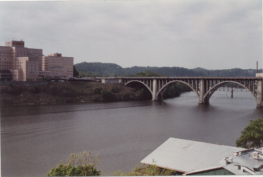
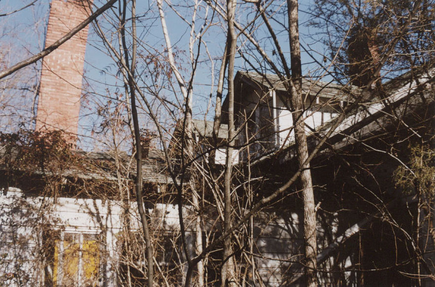
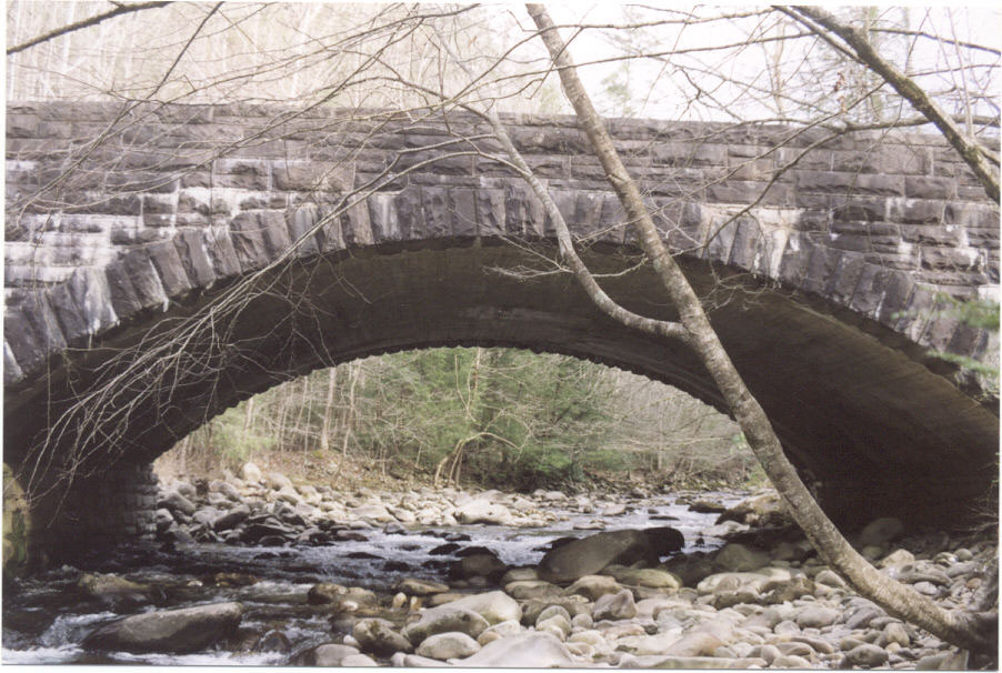
Why would the father choose this particular route to travel? The route chosen would hardly be the most direct way to the southern coast, and it was not accidental as the father had an oil company map that he frequently consulted. Early on the father picks-up a telephone and dials the number of his father's home. Why did he do that? Surely he was not expecting anyone to answer. It seems to me that he had planned the trip through Knoxville, and nearby places, as a way of acquainting his son with his roots. There are personal references to the father's childhood experiences at Norris Dam watching a falcon (p. 17), at his family home in Knoxville remembering Christmas, the yellow brick hearth, and his childhood dreams (pp. 21-23), looking into a pool below a stone bridge in the Great Smoky Mountains National Park where he had watched the trout's shadow on the stones beneath them (p. 25), and at Newfound Gap where he once stood with his own father (pp. 28-29).
It seems to me that the importance of the route is that McCarthy is fictionally returning once again to his own roots in Knoxville and the southeast, to some of the places where the author spent the earlier years of his life. I believe that it is no accident that these places are the ones that are described in the most detail in The Road. Observations such as these would seem to make other autobiographical interpretations of the text more plausible.
Chabon, Michael. (2007, February 15). After the apocalypse. New York Review of Books, 54(2), xx.
Kennedy, William. (2006, October 8). Left behind. The New York Times, pp. 1, 10-11
McCarthy, Cormac. (1965). The Orchard Keeper. New York: Random House.
McCarthy, Cormac. (1968). Outer Dark. New York: Ramdom House.
McCarthy, Cormac. (1974). Child of God. New York: Random House.
McCarthy, Cormac. (1979). Suttree. New York: Random House.
McCarthy, Cormac. (2006). The Road. New York: Alfred A. Knopf.
Shea, Mike. (2006, October). Book Reviews. Cormac McCarthy: The Road. Texas Monthly, p. xx.
Weeks, Jerome. (2006, September 25). Barbarism rages in a Southwest seized by nuclear winter in Cormac McCarthy's fierce futuristic tale. The Dallas Morning News, p. xx.
| To Morgan's Homepage | Return to Top of Page |
"A Concordance to The Road by Cormac McCarthy" can be obtained from John Sepich & Christopher Forbis.
 Wesley G. Morgan,
Ph.D.
Wesley G. Morgan,
Ph.D.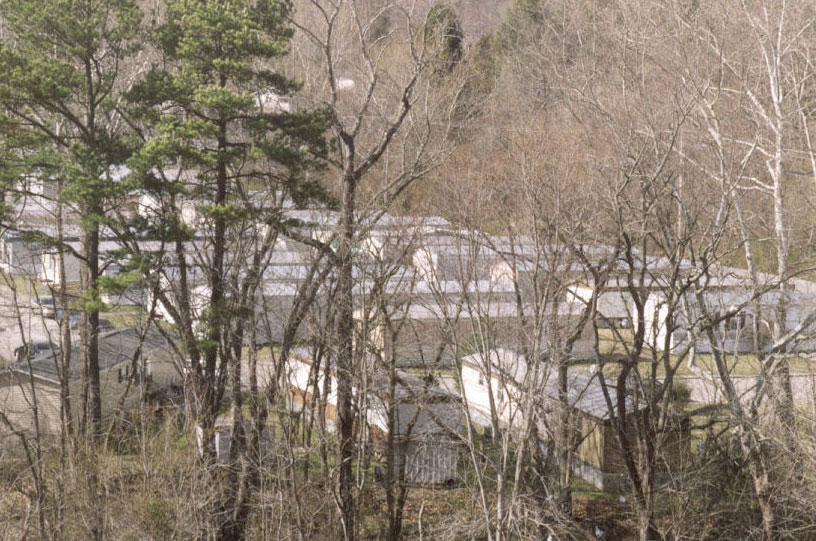
Last Revised: 10 May 2007