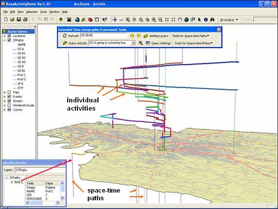
| 3D GIS Implementation of Representing Space-time Paths and Individual Activities |
|
|
|
|
| This figure shows our implementation result of representing and visualizing space-time paths and individual activities in GIS. We used and adjusted the z dimension in ArcScene, the 3D viewer of ArcGIS, to represent the time dimension of Hagerstrand's space-time system. A temporal dynamic segmentation method is created to help us locate each individual activity along a space-time path with the starting and ending times of the activity. |